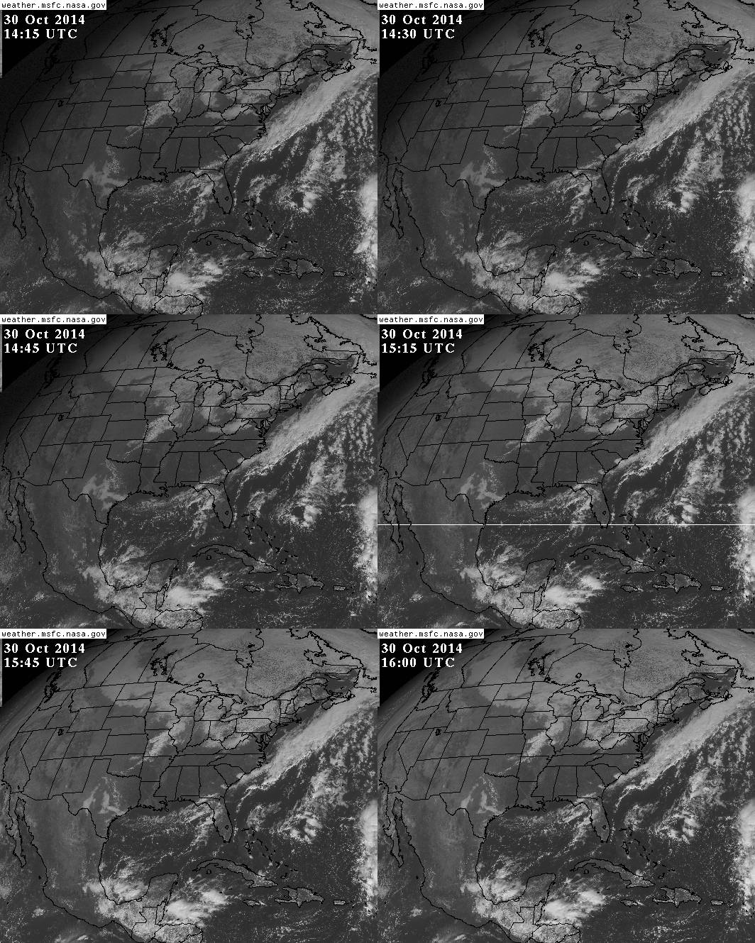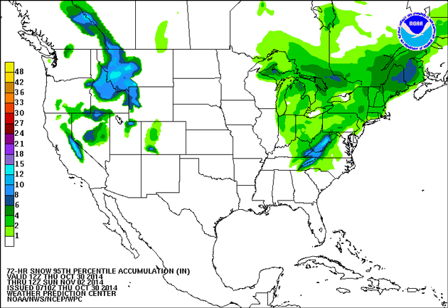
Happy Halloween! Hope you have a good costume lined up that isn’t this horrible “sexy Ebola nurse” one. Anyway, this year the weather seems pretty determined to mess with your trick-or-treating plans: We’ve already seen pumpkin prices spike thanks to the ongoing drought in California. And now it seems that a snowstorm is headed for the Midwest and East Coast. But fear not: It’s unlikely that the goblins and witches in NYC, DC, and other eastern cities will get hit too hard tomorrow night.
The map above is the most recent snow accumulation forecast from the National Weather Service, a prediction of how many inches of snow are expected to fall between today and Sunday. It looks worse than it probably will be; this is the 95th-percentile estimate, meaning snowfall is 95 percent likely to be less severe than what is shown here. AccuWeather has a good map showing the trajectory of snowfall over the weekend, as it moves from the Appalachians on Friday up to Maine by Sunday. And the Weather Channel has a useful daily breakdown here. The upshot is that Midwesterners should plan to bundle up, and Mainers could have snow by the end of the weekend, but East Coasters don’t need to worry too much about snow-proofing their Halloween costumes.
That said, even without snow it could still be cold and blustery, as our friend Eric Holthaus at Slate points out. The NASA satellite imagery below depicts the Nor’easter currently straddling the eastern seaboard, which the latest NOAA forecast says will bring “much colder weather” and possibly some showers by Saturday. So whatever ridiculous “sexy” costume you decide to wear tomorrow, probably pack a sweater.
